 Catalogue PIGMA
Air temperature
Type of resources
Available actions
Topics
Keywords
Contact for the resource
Provided by
Years
Formats
Representation types
Update frequencies
status
Scale
Resolution
-

The MONICAN web page provides access to real-time or archived measurements and operational forecasts of the oceanographic conditions prevailing in the Nazare Canyon area of influence. Near real-time measurements in the Nazare Canyon area are collected hourly by the MONICAN network. This network includes two multi-parametric platforms measuring waves, meteorogical parameters (wind, atmospheric pressure, air temperature and relative humidity), sea surface temperature and (for one of the platforms) water temperature in the upper 200m and currents in the upper 100m. The MONICAN network also integrates two coastal tidal stations providing sea surface level measurements in the ports of Nazare and Peniche , and one coastal meteorological station providing meteorological measurements in the area of Ferrel. The near real-time data is presented in graphical form (namely by combining observations and forecasts) and can be accessed in table form. Forecasts of the wave conditions affecting the coast of Nazare are also included.
-
-

-
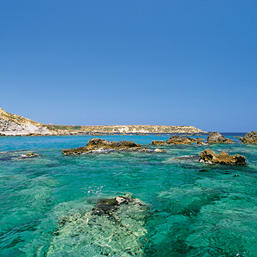
POSEIDON is an operational marine monitoring, forecasting and information system for the Greek Seas. The observing component is a distributed infrastructure made by three coastal buoys (Saronikos buoy-SB, Heraklion Coastal Buoy-HCB and Athos buoy-AB) and one FerryBox (PFB). A calibration laboratory (see Chapter 2) is supporting the observing activities. The Athos buoy is equipped with meteo sensors and T, C/S, DO, fluorescence and turbidity sensors up to 100m in depth, is located in the coastal area in the Northern Aegean, representative of mesotrophic to oligotrophic conditions affected by circulation. Although coastal the depth of the water column allows deeper observations.
-
The Global Sea Level Observing System (GLOSS) was established by the Intergovernmental Oceanographic Commission (IOC) of UNESCO in 1985 to establish a well-designed, high-quality in situ sea level observing network to support a broad research and operational user base. Various tide gauge networks have contributed to GLOSS, each with a different focus and each changing over time as research priorities evolve. The main component is the GLOSS Core Network (GCN), a global set of ~300 tide gauges that serves as the backbone of the global in situ sea level network. GCN gauges were allocated to each island or group of islands at intervals not closer than 500 km, and along continental coasts at intervals generally not less than 1000 km. Preference was given to islands in order to maximise exposure to the open ocean. Established in 1933, the Permanent Service for Mean Sea Level (PSMSL) is responsible for the collection, publication, analysis and interpretation of sea level data from the global network of tide gauges, including the GLOSS Core Network.
-
The mission of OceanSITES is to collect, deliver and promote the use of high-quality data from long-term, high-frequency observations at fixed locations in the open ocean. OceanSITES typically aim to collect multidisciplinary data worldwide from the full-depth water column as well as the overlying atmosphere. OceanSITES delivers high-quality data from long-term, high-frequency observations at fixed locations in the open ocean.
-
Data from FerryBoxes on ships of opportunity going on permanent routes are stored inside this database (ferrydata.hzg.de). Parameters are temperature, salinity, chlorophyll-a fluorescence, oxygen and different others. The data model is transect oriented. A data portal to access and visualise the data is also provided.
-
GO-SHIP, the Global Ocean Ship-Based Hydrographic Investigations Program, is conducting repeat hydrography with high accuracy high precision reference measurements of a variety of EOVs through the whole water column. A selection of continent-to-continent full depth sections are repeated at roughly decadal intervals. The data archive for CTD data and bottle data is currently at CCHDO, although the CTD data from European cruises are available at Seadatanet as well.
-

SeaDataNet is a standardized infrastructure for managing the large and diverse marine data sets collected at sea by the oceanographic fleets, the ships of opportunity and the automatic observation systems. The SeaDataNet infrastructure network sand enhances the currently existing infrastructures, which are the national oceanographic data centres or data focal points of 34 countries, active in data collection. The networking of these professional data centres, in a unique virtual data management system provides integrated data sets of standardized quality on-line. As a research infrastructure, SeaDataNet contributes to build research excellence in Europe. SeaDataNet connects together more than 100 data centres aiming at preserving and making re-useable marine observations ranging from ocean physics to chemistry and biology. SeaDataNet infrastructure was implemented during the SeaDataNet project (2006-2011), grant agreement 026212, EU Sixth Framework Programme. The second phase, SeaDataNet 2 project (2011-2015), grant agreement 283607, EU Seventh Framework Programme has upgraded the SeaDataNet infrastructure into an operationally robust and state-of-the-art Pan-European infrastructure for providing up-to-date and high quality access to ocean and marine metadata, data and data products by: setting, adopting and promoting common data management standards, realizing technical and semantic interoperability with other relevant data management systems and initiatives on behalf of science, environmental management, policy making, and economy. SeaDataCloud project (2016-2020), grant agreement 730960, EU H2020 programme, aims at considerably advancing SeaDataNet Services and increasing their usage, adopting cloud and High Performance Computing technology for better performance.
-
EMODnet Physics provides a combined array of services and functionalities to obtain free-of-charge data, meta-data and data products on the physical conditions of European sea basins and oceans as recorded by more than 20.000 platforms (fixed stations, surface loads, ARGOs, HF radars, etc.) The system provides full interoperability with third-party software through WMS services, Web Services and Web catalogues in order to exchange data and products according to the most recent standards. EMODnet Physics builds on and is based on the cooperation and collaboration with the three established pillars of the European Oceanographic Community: 1) EuroGOOS and its Regional Operational Oceanographic Systems (ROOSs); 2) Copernicus Marine Environment Monitoring Service (CMEMS) , and in particular with the In Situ Thematic Assembly Center (INSTAC); 3) SeaDataNet network of National Oceanographic Data Centres (NODCs). Data are made available by EMODnet Physics, funded by the European Commission Directorate General for Maritime Affairs and Fisheries, in collaboration with Copernicus Marine Service (CMEMS) and EuroGOOS ROOSs INSTAC. Delayed mode data integrates the best available version of in situ data. These data are collected from national observing systems operated by EuroGOOS ROOS members, SeaDataNet NODCs completed by main global networks